
Composite UHI Index 2024 (MDPI Paper Dates)
Findings
Analytical composite index derived from satellite inputs — not a direct land-surface temperature reading. Use this when prioritising places for cooling, greening, or follow-up study.
This is surface temperature from satellite, not the air temperature measured by weather stations or felt by pedestrians.
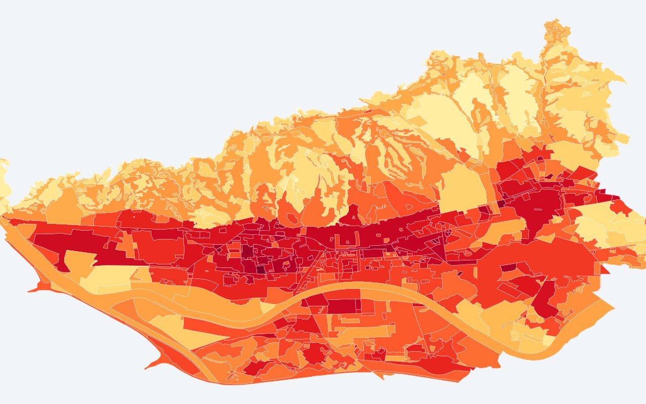
What it shows
Per-Urbana-pravila polygon: temperature minus vegetation greenness, computed on the original 2024 imagery dates used in the paper (Bečić & Gašparović, Land 2025). Higher value = stronger UHI signature in index space.
Data sources
Google Earth Engine Landsat 8/9 Collection 2 (2024 summer dates matching the published study, mean-composited land surface temperature/vegetation greenness); per-polygon zonal means (zonal averages over polygons at 30 m, MDPI-style) on City of Zagreb GUP urban-rule polygons (UrbanaPravilaGUP, layer 7).
How it was prepared
Indicators are calculated from the project’s Zagreb heat, greenery, and population analyses, then drawn on planning-relevant units (neighbourhoods, districts, or parcels).
Interpretation limits
Analytical composite index derived from satellite inputs — not a direct land-surface temperature reading.
Citation
Bečić, D.; Gašparović, M. (2025). Urban Heat Islands and Land-Use Patterns in Zagreb: A Composite Analysis Using Remote Sensing and Spatial Statistics. Land, 14(7), 1470. DOI: 10.3390/land14071470